|
| Evening at camp on Day 1 at Spanish Flat |
Prologue:
I've known about the Lost Coast Trail for decades, but it has eluded me to this point. Why? Because I'm a High Sierra snob. Whenever I've got a little time for a hiking trip, I'm lured to the High Sierra, with few exceptions.
But recently, I participated in a cycling "gravel race," in the Usal area of the Lost Coast. This event included a weekend of camping at Usal Beach, south of Shelter Cove, and I fell in love with the place. So much so, that I was inspired to quickly put together a Lost Coast Trail trip.
I did my research, and discovered the end all of information sites for my trip. This well written,
Hikers Guide to the Lost Coast Trail has everything the hiker needs, and more, to plan, experience, and enjoy, the 25 mile trip. Two updates, though. First, you will now need a
Permit from BLM, and you will need the updated information for a shuttle at
Lost Coast Adventures.
Getting the trip arranged turned out to be more of a chore than I expected — Several things have to line up:
1- A permit must be available on your preferred day. Popular days fill fast, plan ahead.
2- Tides must be right. Mid day low tides are good.
3- Weather has to be right, and this includes a lack of surf advisories on clear days.
4- A shuttle has to be available on your date (not a problem if you drive yourself, or have a group of 4 or more, the minimum requirement for a shuttle run).
After some back and forth, and a change in the weather forecast, everything fell into place for me. Four other folks had booked a shuttle on my day, so I was able to add myself to the roster.
Day 1 - Mattole River to Spanish Flat:
My shuttle is arranged for 10:00 AM, on October 22, 2018. Despite being off season, and a weekday, I got the last available permit. Though there are 30 permits available per day during off season, I don't think more than 10 people actually showed up to do the hike. There were a total of 5 in our group. Two couples, plus yours truly on a solo adventure.
The other four had huge packs, and I wondered what they were bringing. I was traveling light, with a 20 lb. pack, not including water. I spoke with Margo, a Dutch woman, and a professor of Engineering at Stanford. She said she travels light on solo trips, but this trip with Rick included many luxury items, including fresh coffee. When I lamented that I'd brought freeze dried coffee, Margo extended an invitation to join her for fresh coffee, if we all made our destination for the day, Randall Creek.
On this 25 mile trip, there are three sections that are only passable at low tide, totaling about 9.5 miles. Today, the low tide window begins at 2:00 PM. Randall Creek is the end of the second impassable section, beginning at mile 5, and ending at mile 9. If the hiker does not make it to this point, then he or she must wait most of the following day before being able to continue, as we are currently in a late afternoon low tide cycle. There are places to camp within the 4 mile impassable section, but then you're stuck there. All in this group have made a goal to make it to Randall Creek, which will allow morning hiking on Day 2.
 |
| Mike, our shuttle driver, hams it up with the available for rent, and required, bear canisters. Margo and Rick get ready to begin. |
Mike drops us off at the Trailhead near the mouth of the Mattole River, in the Sprinter van, at 12:30 PM. A late start for a hike, but due to the tides, it's actually perfect.
OK... We've got 9 miles to Randall Creek. Lore has it that hikers can only average about 1.5 mph in the soft sand and rocky terrain found along the route. Sunset is at 6:30 PM. I do the math... If I don't stop at all, I have a chance to make it to Randall before sundown, with six hours to hike 9 miles at 1.5 mph, and six hours of daylight!
Game on. I hoist my pack on my back and take off toward Punta Gorda. I immediately understand about the slow going. The soft sand isn't conducive to speedy hiking. After a bit, I look back, and can see a half mile or so behind me. No sign of my fellow hikers.
 |
| Hiking along the beach is slow going, no way around it. |
Mike pointed out, joking, that there is very little elevation gain on this hike... unless you count the three inches or so, that you sink with every step. I find myself wandering like a drunken sailor, seeking terra firma, where each step might result in less slogging in the sand. Too far from the water in dry sand is no good, nor is too close to the water. But this isn't always the case, it's a complex formula that never seems to be consistent, hence continual experimentation and wandering to find the path of least resistance.
In pre European times, this area was inhabited by the Mattole people. They spent summers near the mouth of the Mattole River, then wintered upstream a bit to avoid the storms. These people were decimated very quickly by white settlers, and little is known about them, their language and history extinguished in short order. We know much more about other native people, but I suppose since this group was rather small, they were easily silenced forever. I'm saddened about this as I walk their land.
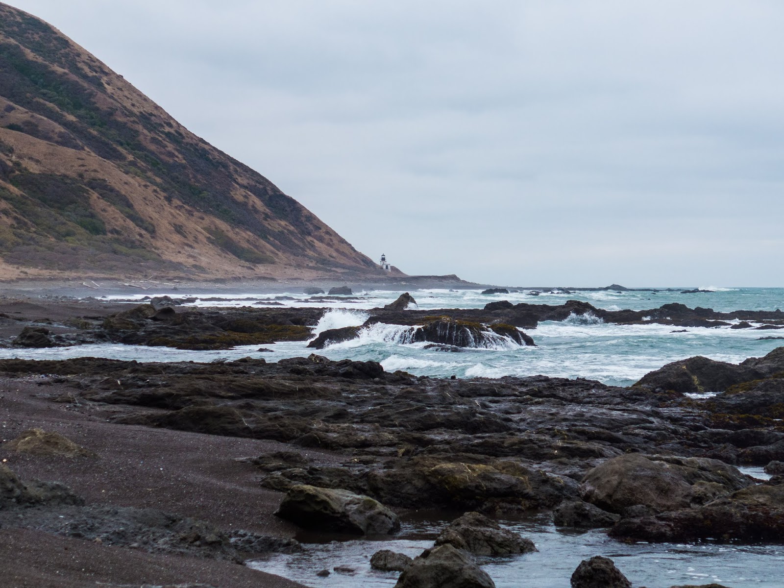
I round Punta Gorda and the lighthouse comes into view from a distance. I do love lighthouses, I mean, who doesn't? This one operated from just after the turn of the century (the other recent century), until 1951. In the 60's hippies occupied the outbuildings, and the BLM eventually burned them all to the ground, getting rid of the hippies, and leaving only the lighthouse, and the oil room.
 |
| Punta Gorda lighthouse comes into view. This area was the site of many ship wrecks in the late 1800's. |
As I near the lighthouse, I walk right through colonies of Sea Lions, resting on the beach. Some feel I am a bit too close, and they let me know, so I keep moving and am ready to flee should they become aggressive.
 |
| See Lions at Punta Gorda |
 |
| Not all Sea Lions were aggressive. This guy didn't even wake up! |
 |
| I approach the Lighthouse. Oil room on the left. |
 |
| The old Lighthouse. Simple but beautiful, it's in a state of disrepair, railing rusting and crumbling. |
I enter the lighthouse, and climb the rusted spiral staircase. Pro tip: Take your pack off before climbing up. The hatch at the top is tiny, and impassable with even the smallest pack. Oh, and watch your head...
 |
| View from the lighthouse. |
 |
| Looking down at the beach from the Lighthouse. Rusted object, probably a tank, is from an old ship wreck. |
 |
| Info plaque at the Lighthouse. |
I enjoy lunch at the Lighthouse, spend maybe 20 precious minutes there, and now it's time to keep moving.
As I head south down the coast, I look back to take one last look at the Lighthouse. Even with my stop at the lighthouse, and looking back from a distance, I still don't see my fellow hikers. I begin to wonder if they will make it to Randall Creek.
 |
| One last view of the Lighthouse from the south. |
 |
| This object on the beach appears to be part of a propeller assembly, possibly from a ship wreck. |
 |
| Heading South from Punta Gorda, I pick up a proper trail for a while. |
After Punta Gorda, the Lost Coast Trail becomes and actual trail for a bit. When you walk on firm ground, it's like stepping on one of those people movers in an airport — the hiker suddenly picks up speed, like a turbocharger kicks in!
 |
| Very clear who goes where. Birds on the three rocks to the left, Sea Lions on the flatter rock on the right. |
 |
Easy hiking along the beach.
 |
| There are several old cabins along the route. All are in good state of repair except for this one at Sea Lion Gulch. |
|
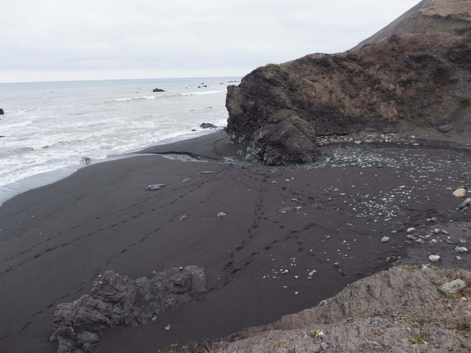
At Sea Lion Gulch, the trail drops down to the beach for a 4 mile section that is impassable at high tide. My timing is good. Despite my lunch break, and leisurely antics at the Lighthouse, I'm on, or ahead, of schedule averaging well over 2 mph.
 |
| Time to drop down to the beach. |
 |
| Plenty of beach to stay out of the surf along this section, though one must always keep an eye on the waves. |
 |
| Cooksie Creek spills into the ocean, and provides fresh water for the hiker. |
 |
| Interesting geological sediment and uplifts along this dramatic terrain. |
 |
| My speedy hiking pays off, and I'm at Randall Creek, my original goal, at 4:30 PM. |
I arrive at Randall Creek well before my goal of sundown. Camping looks a bit limited, so I decide to leave it for my shuttle mates, should they make it there, and carry on to Spanish Flat. I'll miss Margo's offer for fresh coffee, but my gut tells me camping will be better at Spanish Flat, and it's only another 2 miles.
 |
| Travel becomes easy again as I work my way toward Spanish Flat in the late afternoon. |
 |
| I find beautiful camping at Spanish Flat. |
I set up my camp in Spanish Flat, not far from the creek, among the driftwood. I enjoy a hot meal with splendid views of the evening sky. It's overcast, but there are some nice sunset colors to the south. I'm happy with my progress for the day, averaging about 2.8 mph while moving.
Day 2 - Spanish Flat to Black Sands:
The long Fall nights mean about 12 hours in the tent, but I enjoy the lazy schedule, and have a nice morning at camp as the light slowly brings the landscape into view. I'm on the trail at about 8:45 AM after the 7:30 AM sunrise. The tent is bone dry, something I would never have expected on this trip!
 |
| Morning Mountain Mocha at Spanish Flat. I suppose in this case it's a Coastal Mocha. |
 |
| Another private cabin along the route. These folks opted not to sell their land to the BLM, and were permitted to keep their property. Note the fire clearing around the cabin. |
I begin my hike along the easy terrain of the trail through Spanish Flat, and encounter one of many private cabins.
 |
| Looking back North at the cabin in Spanish Flat. |
 |
| Looking South from Spanish flat. You can see another hiker in this photo. This young man is traveling light, and setting the same speedy pace as me, and I will see him several times during the day. |
 |
| Similarly shaped, but very different objects, this tank, and log were apparently deposited here by high Winter storm surf. |
 |
| Another private cabin along the route. Again, you can see fire clearing, and apparently, it paid off, as a fire swept through here years ago. |
 |
| Looking down the coastline to the South. Time to head down to the rocky shore again, and leave terra firma. |
 |
| Beautiful section of trail heading toward Miller Flat. |
 |
| By far the fanciest private "cabin" along the route, this huge, luxurious home, complete with private airstrip. |
 |
| Private airstrip for the two cabins here. Tracks are from the small plane turning around to prepare for take off. Surfing appears to be good at this location. Note the wind sock. |
Heading toward Miller Flat, the hiking is easy and fast. As it turns out, I am ahead of schedule to tackle the next section that is impassible at high tide. The window opens at about 2:30 PM, and it's not even noon yet. I hatch a plan to hike up Rattlesnake Ridge trail, to burn off a couple of hours. I decide to ditch my pack in the woods, and make a fast and light ascent of the ridge, carrying only my camera and Garmin. But I make a terrible blunder...
 |
| I ditch my pack off the trail, out of site, in the woods. I remove the bear canister from the pack and leave all pockets open, so curious critters won't chew it up. |
I start heading up toward Rattlesnake Ridge, and after about a half mile or so, I realize that I'd separated some lunch food from the bear canister, and it is exposed for the taking by critters. Oh no! I debate what to do. It's probably OK, but I decide to return to the scene. At this point, I've lost precious time, so I decide to abort the mission, and repack my pack.
 |
| Miller Flat is known for abundant wildlife. |
 |
| A buck takes note of me. |
 |
| The next stretch of the coast will prove to be the most difficult, at least in terms of dealing with the surf. I wait it out here, as the tide needs to recede a bit more, and a fellow hiker does the same, from his perch above the ocean. |
 |
| Too early to negotiate the next dangerous section because of the tide. Only one thing to do... Nap time. |
I nap for an hour, and I've had enough. It's about an hour too early to negotiate the next section, and the tide has not receded enough, but I decide to go for it anyway. This section will turn out to be the only part of the trip that is really dicey.
 |
| The strategy is to round the difficult sections between waves, not always easy... I barely got 'round this last section before getting hammered by a wave! |
In this section, the hiker must watch the wave sets, and then, on the lesser waves, make a mad dash around the lower points to safety. Unfortunately, some of these sections are longer than one would like, so a full sprint is necessary. In a few places, there is no way I can make it in time, so I find myself climbing up, steep, wet, slippery, sharp rock, clinging to the cliff, as the waves crash below. Then down climb, make another dash, and repeat.
I should mention that the worst danger here is getting soaked. The waves are not so high that they would pull me out to sea, at least I don't think so, but I really don't want to get my boots wet! No sneaker waves seem to be happening. Just normal wave sets, so the hiker needs to be patient, and cognizant as to how the waves are behaving.
 |
| We, my fellow speedy hike and I, get through a bad section, then are treated to an easier section... but the next bit on the right of the photo, will present more challenges, as the waves crash against the cliff! |
Hiking gets easier for a bit, then becomes difficult again. By now we are in the window where the tide should be low enough according to recommendations, but I think the surf today is a bit higher than normal. No sneaker waves, no small craft advisory, just a bit higher than the norm.
 |
| Fresh water meets the sea, and creates colorful rock. |
 |
| Another tough section... if the rocks are wet, the hiker will be wet too if the timing between waves is missed. |
 |
| Shipman Creek spills into the sea. |
 |
| Gulls take a break and drink fresh water from Shipman Creek. |
 |
| Colors caused by fresh water seepage. |
 |
| Past the difficult section, and on to safer beach hiking. |
 |
| The last section on Black Sands Beach toward Horse Mountain Creek. Shelter Cove, the end of my hike, is the point on the right of the photo. |
 |
| Unbelievable variation in subtle pastel colors in this large shell, about 6" in diameter. |
As I approach Horse Mountain Creek, it's 5 PM, and I realize I only have about 1.5 miles to Shelter Cove. I can easily make it to my car before sundown, making this three day hike in a day and a half. I could then grab a motel, and head out to the Brew Pub. Or... I could make camp at Horse Mountain Creek, enjoy another night of camping on the beach, along with a nice sunrise, then hike out in the morning, and drive home.
The latter plan wins out, as the weather is perfect. Relatively warm, with no wind, and a sky that looks like it will deliver a nice sunset.
 |
| Horse Mountain Creek, spilling out of the woods and onto the beach. |
I set up my camp and enjoy the evening sky. I cook up a quick dinner, then take an evening walk along the beach at twilight. The sky is incredible, and the surf beautiful. I'm happy with my decision to stay.
 |
| I set up camp a bit above the high tide line. Should be OK.... |
I'd never think I could get away without a rain fly on this hike, but last night's dry tent experience makes me decide to forego the rain fly. But as I'm just about to retire, I feel a little drizzle coming down, so wisely, I put on the rain fly. As it turns out, it'll be a moist evening, with plenty of fog drip.
 |
| I took dozens of wave photos this evening, walking along the beach at dusk. All are beautiful, but I will leave you with this one, certainly one of the best. |
 |
| I lied. One more. |
 |
| Near my camp is Split Rock. This was my turnaround point on my evening hike. I am camped near the driftwood on the right of the photo. |
 |
| Just before retiring to my tent for the night. |
 |
| This is the night before the full moon. This shot was taken around midnight, entirely moonlit, with a 15 second exposure. |
It's a warm, windless night. In my tent, my Garmin is reading 65 degrees! Too warm to climb in my bag. After a while, the temperature drops to render more comfortable sleeping. By morning, the temperature will be 45 degrees. I suspect the warm sand underneath the tent gave a somewhat false reading at nightfall.
Day 3:
 |
| Morning at camp. |
 |
| I elected to go ultralite on this trip. Windscreen on left, small alcohol stove, single titanium pot, and large plastic yoghurt bin cut off to use as a bowl. And, not pictured, a Sawyer Squeeze water filter, and Osprey Levity 45 pack. I wasn't thrilled with the alcohol stove, everything else was great. Probably will not use the alcohol stove again. Note bugs in bowl... |
In the morning I find literally thousands of little bugs hopping around in the wet sand. These bugs crawl around, then flick themselves into the air traveling about a foot in height, and in distance. There are hundreds of them in every square meter. I put a pot of water on my stove, the top of which is a foot off the ground, and within seconds, there are three of the little buggers in my coffee water! It's insane!
If I squint my eyes, the sand seems to be moving, there are so many of them. It's like something out of a Sci Fi horror movie. The good news is that they don't bite, but I've got to keep everything covered. They flourish in the wet sand, but once the surface dries, they are gone, presumably burrowing down to moisture underneath.
A bit of research after returning home indicates that these are Beach Hoppers, sometimes called Sand Fleas, but are actually not fleas at all, nor are they insects. They are actually crustaceans, and are mostly nocturnal, burrowing under the sand during the day, hanging around in, or just above, the tidal zone (where I am camped ;-).
Pro Tip #2. If you don't want to be hammered by Beach Hoppers, then camp a comfortable distance above the high tide line.
 |
| Beach Hopper. The ones I encountered are darker, and 1/4" to 1/2" in length. |
I realize at this point that I haven't yet got my feet wet in the surf on this trip, so I take the time to head down to the waves, and frolic a bit in the surf, being careful not to get sucked in. The surf is quite dangerous in this area.
 |
| My tent is soaked and full of bugs, so time to shake it out before I head out. |
I pack up, and hike the easy 1.5 miles back to my car at Black Sands Beach in Shelter Cove. Fresh and rested, the drive back to the San Francisco Bay is easy, with a stop in Whitethorne, at Caffe Dolce, for more coffee and a breakfast sandwich.
The Lost Coast Trail is a great experience, even for this High Sierra Snob. A unique, and fun challenge, traveling through a very special, and remote place. Highly recommended.